India has developed a unique history due to its diverse geographical position. From the Himalayan mountain range to the Deccan Plateau in the south, various features of the geography have profoundly influenced the political, cultural and economic development of India. Let us now examine how such geographical diversity has shaped the history of India.
Major geographical features that shaped India:
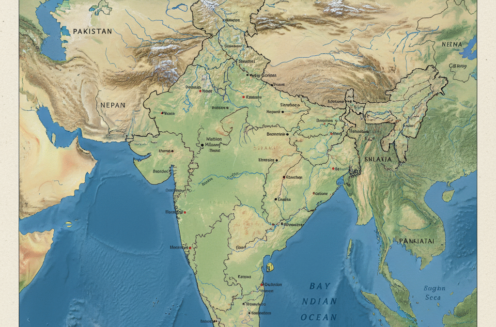
The Himalayas in the north, Suleiman, Kirtar and Hindukush valleys in the north-west, Manipur plateau in the north-east, Bay of Bengal, Western Ghats, Aravalli, Vindhya and Satpura hills in the east, Deccan plateau in the south, Indus, Ganga, Brahmaputra rivers, coastal region etc. form the culture and various political units of India.
1. Himalayas: India's natural protector:
The Himalayas divide India from the rest of Asia. It blocks the cold winds from entering India and provides cool air. The Himalayas have given birth to ever-flowing rivers. These rivers have created the fertile plains of the north. Due to this, North India has become economically prosperous. These rivers bring alluvial soil and crops such as wheat, jute, sugarcane and paddy grow abundantly here. The valleys paved the way for foreigners such as Persians, Greeks, Turks and Afghans to invade India. As a result, Indians were able to develop commercial and cultural ties with the West.
2. The Indus-Gangetic Plain: A Journey of Civilizations:
The Indus-Ganga rivers have had a lot of influence on the cultural life of Indians. The Indus Civilization and Vedic Civilizations developed in the plains of these rivers. In addition, the Mauryas, Guptas, Vardhanas, Delhi Sultans and Mughals established empires on the banks of these rivers. Multan, Takshashile, Indraprastha, Kanauj, Ayodhyavaranasi, Pataliputra, Sarnath, Vaishali etc. grew up here, followed by Karachi, Lahore, Agra, Kanpur, Murshidabad, New cities like Dhaka and Kolkata arose.
")
3. Deccan Plateau: Home to a Prosperous Race:
The Dakkhan Plateau is densely forested and has transformed the people into hard workers and war lovers, while the river plains are rich in natural wealth and have enriched the lands. The river plains of South India like Narmada, Tapati, Mahanari, Godavari, Tungabhadra, Kaveri etc. led to the prosperity of Satavahana, Ganga, Kadamba, Chalukya, Rashtrakuta, Yadava, Hoysala Vijayanagara, Bahmani, Bijapur, Mysore, Chera, Chola and Pandya kingdoms eg Paithan Hampi. Cities like Srirangapatna Srirangam and Thanjavur grew up on the banks of these rivers.
")
4. Eastern and Western Ghats: Land of Wealth:
The Eastern and Western Ghats are not just green hills, they are full of natural treasures. Honne, teak and sandal trees grow here in abundance. In addition, substantial iron and steel wealth in the region contributed to India’s industrial growth.
")
5. Coastal regions: Bridge of Commerce and Culture:
From coastal ports, Persians, Greeks, Arabs, Jews, Chinese established trade relations with India. This allowed cultural contact. In modern times, Europeans like Portuguese, Dutch, French and English were able to come to India. This allowed India to do foreign trade. As a result, Indian spices, gems, cotton. etc. started to be exported from India. Iron, copper, gold mines, stones needed for the development of architecture were found here.
Conclusion
India is rich in different geographical features, which have a significant impact on the country’s habitat, economy, agriculture, and culture. Its unique geographical features, the Himalayan mountains, the southern sea coasts, the vast Ganga-Brahmaputra plains and diverse environments make up the realistic image of the country. Collectively, India’s geographical features form the backbone of the country’s cultural diversity, economic prosperity and lifestyle.